
The El Capitan Property
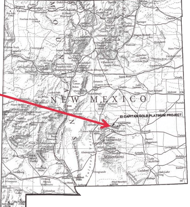
The El Capitan property consists of 354 Bureau of Land Management (BLM) lode claims and four patented claims. The claim block is located in Lincoln County, New Mexico and occupies a total of approximately 3,000 acres in townships T 7 S, T 8 S and range R 14 E. The BLM lode claims were staked and recorded by consultants employed by El Capitan Precious Metals, Inc. and personnel of the company. The El Capitan property is owned by El Capitan Ltd., an Arizona corporation. El Capitan Precious Metals, Inc. purchased a 40% equity interest in El Capitan Ltd. from Gold and Minerals, Inc. in 2002. In 2011 the merger of Gold and Minerals and ECPN was complete. ECPN now retains a 100% equity interest in the property.
El Capitan Project Regional Geologic Setting
The El Capitan deposit is located at the most prominent structural intersection in New Mexico, within perhaps the greatest exposed concentration of Tertiary intrusions in New Mexico (Cather and others, 1991), and is apparently underlain by a large mafic or ultramafic intrusion. The structural intersection is formed by the north-south-trending axis of the Pedernal uplift-Mescalero arch and the east-west-trending Capitan lineament. In the south, the Pedernal-Mescalero axis closely parallels the Sacramento uplift, an east-tilted fault block with evidence of at least three periods of deformation (Precambrian to late Tertiary), and in the north it closely parallels a series of faults and folds in the Picuris-Pecos trend. The Pedernal-Mescalero structural zone coincides generally with a belt of crustal thickening and alkalic intrusions (Bird, 1984) that marks the boundary between the tectonically active Rio Grande Rift (a branch of the Basin and Range) and Rocky Mountains on the west and the tectonically stable Great Plains on the east. The Pedernal-Mescalero axis appears to be offset approximately 10 miles across the Capitan lineament (Cather and others, 1991). The Capitan lineament is a well- defined basement fracture and magmatic zone that may be traced for over 300 miles from Socorro, NM into western Texas; in the area of the El Capitan deposit the lineament is reflected by the Capitan pluton.
The Tertiary intrusions form the Lincoln County porphyry belt that includes at least 11 stocks and laccoliths. The east-west elongate, 20 mile-long Capitan pluton is a Miocene aplite (granitic) laccolith that plunges westerly and underlies the El Capitan deposit. Thompson (1991) concluded that magmas in the porphyry belt were generated from both lower crustal and upper mantle sources and McLemore (1991) concluded that a diversity of mineral deposit types in the El Capitan region resulted from several different complex magmatic fractionation and differentiation events. Roberts and others (1991), show a coincident steep-gradient aeromagnetic anomaly and a gravity anomaly. These anomalies cover an area of over 270 square miles, show northerly and easterly structural trends, and are interpreted as reflecting a large mafic or ultramafic intrusion that underlies the Lincoln County porphyry belt and the El Capitan deposit. It is possible that precious metals bearing hydrothermal fluids that formed the El Capitan deposit were differentiates from this buried mafic or ultramafic intrusion.